
The Maui County Real Property Tax website is a valuable tool for property research, offering detailed insights for potential buyers, investors, or homeowners. Here’s why it’s helpful:
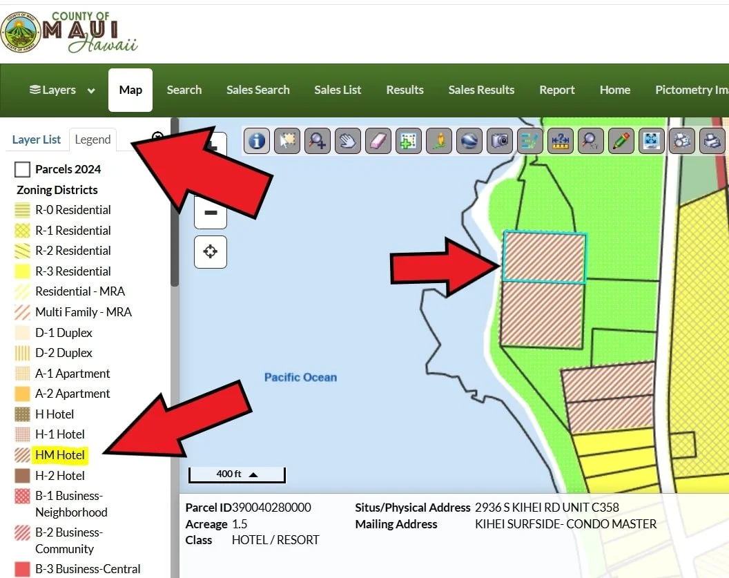
Zoning Information: Check county zoning (e.g., residential, commercial, agricultural) to understand permitted uses and restrictions.
Flood Zones & Sea Level Rise: Access GIS maps to identify flood zones and assess sea level rise risks, critical for coastal properties.
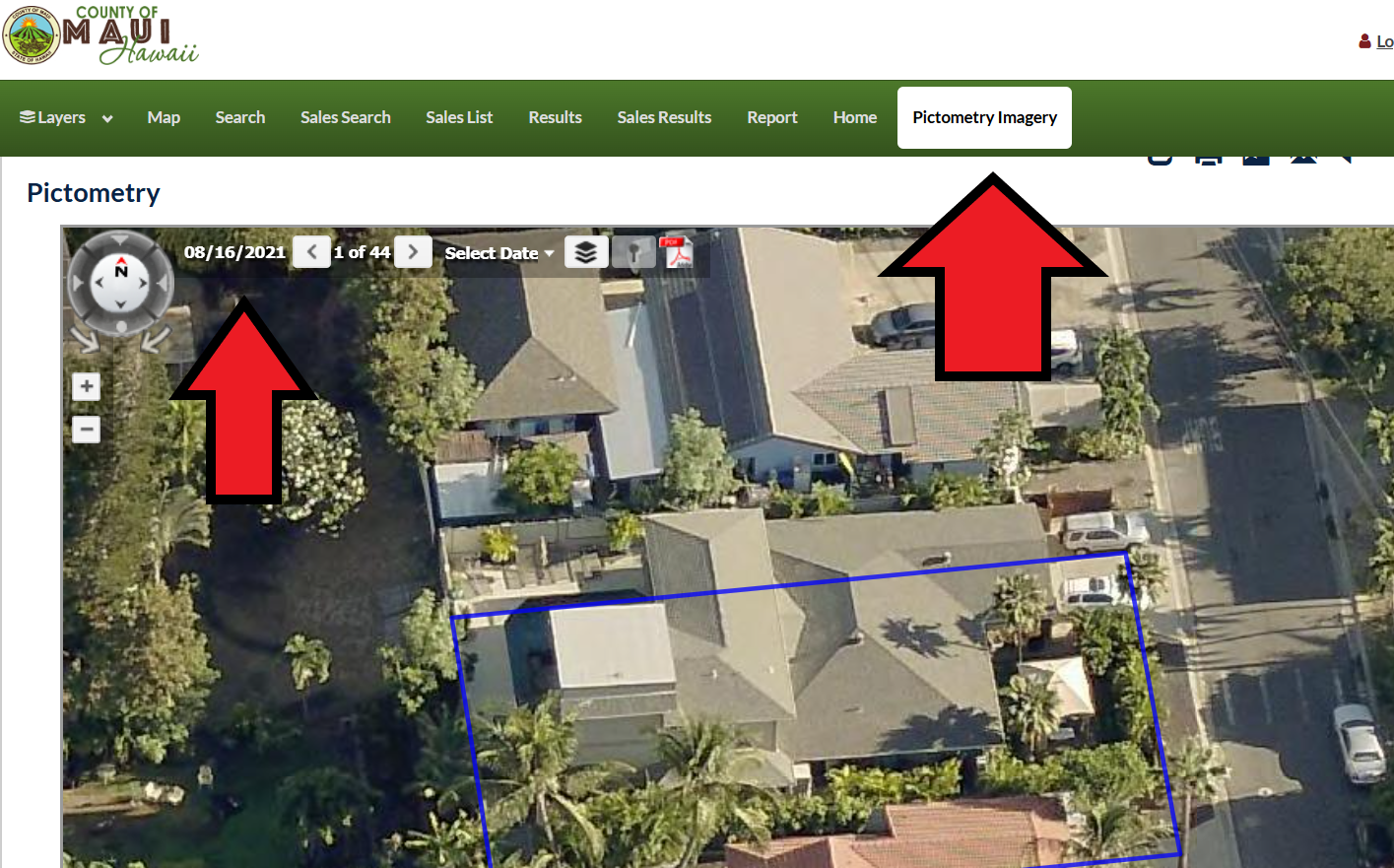
Terrain Analysis: View satellite imagery to evaluate gulches, sloped vs. flat land, and general land characteristics; most Maui properties may not include gulches, depending on location.
Neighbor Proximity: GIS maps show property boundaries, helping estimate how close neighbors are.
Neighboring Land Use: Satellite imagery may reveal if neighbors store large commercial equipment or operate rooster farms, indicating potential nuisances.
Listing Accuracy: Compare tax records with listing information to verify details like square footage or improvements; discrepancies may suggest issues.
Non-Conforming Work Clues: Tax records may show unpermitted improvements, but the Planning Department confirms compliance.
Historical Satellite Imagery: Track changes over time, like roof replacements or terrain shifts (lush vs. dry), to assess property history.
Listing Photo Insights: Tax record imagery may reveal details omitted by listing agents, who might exclude photos to present the property favorably.
Access these features via the Maui County Real Property Tax website using a parcel’s TMK number, address, or owner’s name.
How to find out the county zoning for a property
type in address on the tax website (link above)
click “Map”
click “Zoning districts”
click “legend”
How to find out if the property is in a special flood zone
type in address on the tax website (link above)
click “Map”
click “Zoning districts”
click “legend”

Where to find the best sattelite maps
type in address on the tax website (link above)
click “Pictometry Imagery” (can be glitchy)