

The Flood Hazard Assessment Tool is an informational mapping viewer developed by the Hawaii Department of Land and Natural Resources. It displays flood hazard zones across the Hawaiian Islands using data from FEMA’s Digital Flood Insurance Rate Maps (DFIRMs), allowing users to search and assess flood risk by various identifiers like address or tax map key.
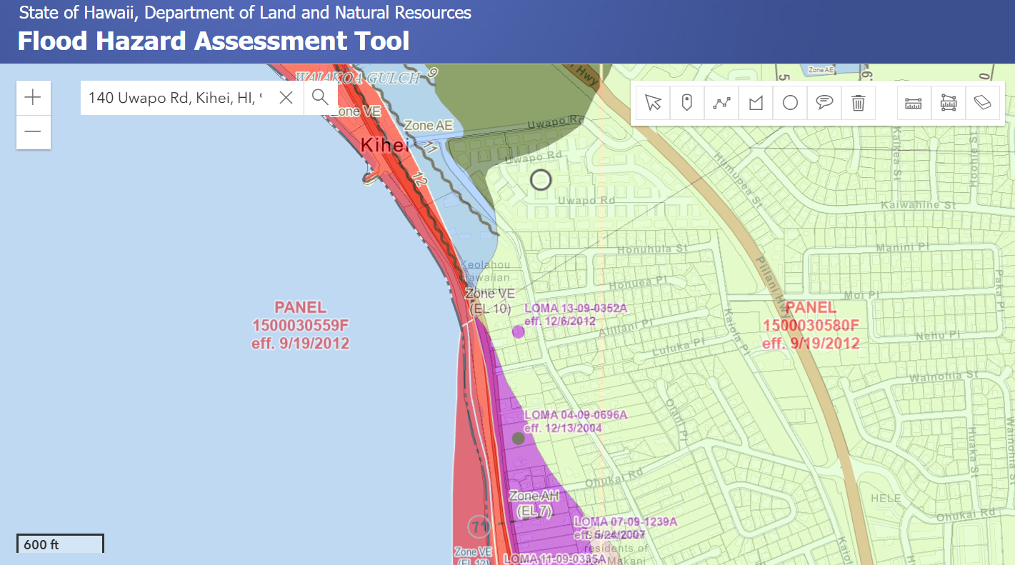
In Maui, flood hazards can be found in several areas, particularly those designated as Special Flood Hazard Areas (SFHAs). These are high-risk areas with flood zones starting with “A” or “V”. These zones are subject to inundation by the 1% annual chance flood, commonly referred to as the 100-year flood.
Locations:
Near Kahului Harbor and in areas like Paia near Baldwin Beach and Sprecklesville.
Maalea to North Kihei near Maalaea Bay and Waipuilani Park, where there are small areas on the outskirts of Lahaina, inland edges of the Keanae peninsula, and around Pāpalaua Wayside Park.
Low-lying areas of coastal Kihei, where the AE zone, which indicates areas with a 1% or greater risk of flooding each year, is particularly noted.
Flood Zone Types:
Zone A: 1% annual flood chance, but without detailed base flood elevations.
Zone AE: 1% annual flood chance, with established base flood elevations.
Zone V & VE: Coastal floodplains with additional storm wave hazards.
Zone X: Outside the 0.2% annual chance floodplain (500-year flood), but not entirely flood-free.
Flood zones may change due to development, climate shifts, or FEMA updates. Even in Zone X, considering flood insurance and checking updated maps is recommended.
Flood Risk & Resources
FEMA Flood Maps: FEMA Map Service Center
National Flood Insurance Program: Flood Insurance & Mitigation
USGS Flood Data: Flood Inundation Mapper
NOAA Weather & Flood Alerts: National Weather Service
Hawaii DLNR Flood Information: State Resources
HUD Federal Flood Risk Standards: HUD Guidelines
Ready.gov Flood Preparedness: Flood Safety Tips
These resources offer tools and data to assess flood risks. Always verify the latest maps and consult local floodplain administrators for accurate information.
Flood Hazard Areas